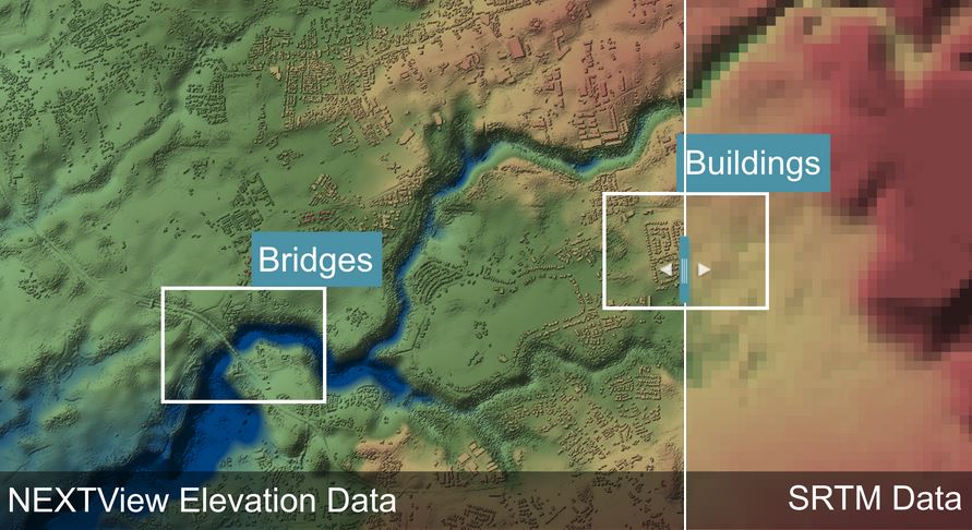
Intermap Technologies, a global player in 3D geospatial data and intelligence solutions, has announced a new contract with Skyroads AG and cloudeo AG to power an Automated Airspace Management and Vehicle Guidance System. Under the agreement, Intermap’s NEXTView™ will be integrated into Skyroads’ system to ensure safety, efficiency and obstacle avoidance as vehicles travel above urban environments.
A joint press release reports “Skyroads is developing a groundbreaking Automated Airspace Management and Vehicle Guidance System to build digital roads in the sky. In collaboration with Intermap and its partner, cloudeo, Skyroads is using Intermap’s aviation-specific terrain data, NEXTView, to build an obstacle management system within its intelligent airspace management system. This system will enable advanced air mobility and interoperability between manned and unmanned traffic in complex urban airspaces. The automated system scales urban air mobility and enables vehicle developers and operators to achieve ambitious commercial goals.
“Intermap’s NEXTView is the world’s first and only high-resolution global terrain dataset designed for the aviation industry. In partnership with Lufthansa Systems, Intermap created NEXTView to provide the aviation industry with the highest quality, continually updated terrain data. NEXTView is the only aviation certified terrain data on the market that can be directly integrated into cockpit systems. Integrating NEXTView into unmanned traffic management systems (UTMs) enables operators to plan and execute unmanned aerial vehicle (UAV) flights based on predetermined flight paths, ensuring safe and efficient operations.
“Intermap’s NEXTView terrain data is also available on cloudeo’s marketplace platform. Cloudeo’s marketplace enables users to create, interpret and use geospatial data for a variety of projects around the world. The marketplace hosts a range of value-added products and services, including Intermap’s NEXTMap elevation datasets and analytics. Intermap’s data products and analytics can be found on the cloudeo marketplace here.”
Learn more about Intermap’s aviation terrain dataset at intermap.com/aviation-surface-data.
For more information
(Image: Intermap)


