The state’s Transportation Department (MDOT) is working with Airspace Link, a provider of data, software and managed services associated with drone flight, to analyse the air traffic and ground infrastructure that would enable flights in shared air mobility corridors. The company will also study the economic and community impacts of BVLOS operations.
Airspace Link’s AirHub Insights software, data and services will contribute to the risk analysis that the state will use to seek FAA approval. The solution analyzes more than 50 datasets — including Esri GIS data and information from federal, state, local governments and third parties — to provide actionable information on safety, economic impact and drone reach, Lisa Peterson vice president of business development at Airspace Link, told GCN.
“This Michigan DOT study is all about what will it take to enable these drones to go 20, 30, 40 miles, which they are capable of,” Peterson said. “But because of the current [FAA] rules and regulations and the need to have the visual observation, you can’t do it. Think of this as a digital visual observer that we’re putting together – the ground infrastructure that’s going to help ensure that these drones don’t conflict with manned aviation, that we are sensing where they are at all times, and if there is an event that happens … there’s a safe landing spot along these areas that has been approved for beyond visual line of sight.”
Since January, the study has looked at how drone BVLOS operations could safely happen in three geographic areas. One is southeast Michigan, particularly the highly populated Detroit area.
“We are trying to look at how we can layer highways in the sky, if you will, above the ground-based autonomous vehicle corridor being developed by Cavnue between Detroit and Ann Arbor,” Tyson said. The corridor project started in 2020 to test the viability of a 40-mile driverless vehicle roadway.
The BVLOS study supports the state’s sustainability goals. “We think that with electric, small aircraft it can actually help reduce carbon emissions of moving goods on ground-based trucks and freight,” he said. “It’s important for us to think about how these can positively impact communities and not cause noise pollution or a hindrance to communities.”
The second study area is international deliveries across the state’s border with Ontario, Canada, and the third targets rural and tribal regions in the northwest where residents might struggle to access vital goods, especially in the winter.
“The outcome of this study would be a report outlining the air corridors in those spaces and what infrastructure would be needed to establish them … and what the economic benefit would be,” said Corey Whittington, director of business development at Airspace Link, reports Government Computer News.
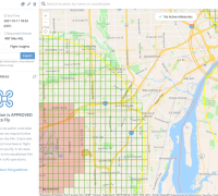
(Image: Airspace Link, Low Altitude Authorization and Notification Capability LAANC)
For more information visit:

