

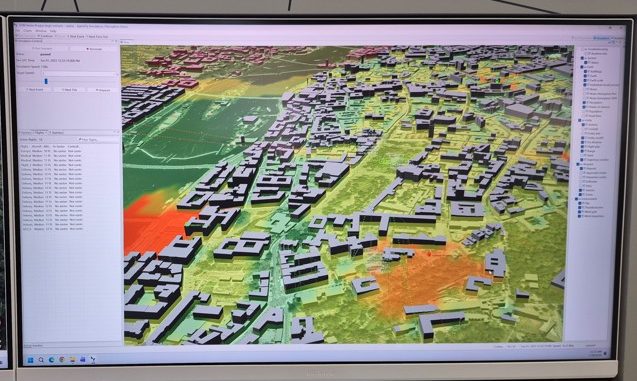
One of the most interesting and innovative displays – a real hidden gem – of Airspace World 2026 was the AgentFly UTM simulation platform, on display by AgentFly Technologies of the Czech Republic. At first sight it looked like a fairly standard simulation platform for evaluating 4D trajectories of drones and ev=VTOLs in an urban environment. But what set this tool apart was the inclusion of a precise public perception algorithm.
The system brings together traditional airspace modelling capabilities – route planning, take-off and landing area identification, 3D modelling to take in terrain, buildings , obstacles and linear infrastructure – with the emotional reaction of the public to different route configurations. Using work done by academic partners to understand how individuals view drones and eVTOLs in terms safety, noise nuisance, privacy issues at various distances, airspace planners can build heat-maps of public concern. The simulation allows airspace planners to map these areas of public concern from an individual to a large crowd, providing invaluable data to city planners on how communities will react to drone and eVTOL operations based on the distance of these aircraft from individuals, groups and large crowds.
For more information
www.agentfly.com
(Image: Heat maps – in red – measure how many people to be impacted by drone/VTOL noise and safety concerns, down to a single individual – Unmanned Airspace)