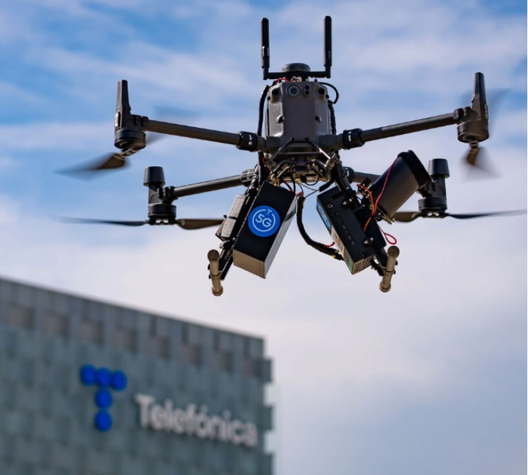
The use case consists of communicating between several drones in flight, as well as with different connected urban elements, in order to make a correct delivery of a package to a mobile collection point. For the first time, several innovative technologies have been combined, namely 5G, C-V2X communications (the same used in the connected car), RTK technology and mobile location, comments GSMA.
According to Telefónica, the demonstration consists of the flight of several drones that communicate with each other and with different urban elements connected with the aim of making a correct delivery of a package in a mobile collection point finding in its path another drone or a notice of a restricted area zone. Drone services company Correos played a role in the development of this project to reach areas of difficult access or even provide new services.
This project is part of the Telefónica 5G Madrid proposal within the call for 5G grants from the Ministry of Economic Affairs and Digital Transformation through Red.es, co-financed with FEDER funds, to promote innovation pilots in 5G in Spain.
To do so, Telefónica has had the collaboration of Gradiant for the development of the intelligent cooperative communications system (based on 5G and C-V2X), the implementation of the solution that allows to offer precise locations and the integration of these technologies in drones and smart elements of the Smart City. Ericsson has also participated with an analysis and study on the location that 5G will bring in the future, and Genasys, a company specialized in LBS services and critical emergency communications, to obtain the location offered by the mobile network currently in commercial mode on which this project is developed and which has been deployed by Ericsson.
Use cases implemented with the pilot
Specifically, the use cases implemented are:
- Traffic coordination between two drones:one drone intercepts the passage of another drone, detecting a risk of collision. One of the drones stops, giving way to the other drone, thus avoiding the collision and then each drone continues on its own route.
- Restricted area warning:a beacon connected on the ground marks a restricted area and constantly reports its location. The drone on its trajectory, upon entering that zone, detects that it is a restricted area, leaves that area and proceeds to go around it, continuing its route.
- Package delivery at a mobile delivery point:the mobile collection point is equipped with the beacon connected in such a way that it periodically sends its position and so the drone goes to that point and makes a precise landing.
All this, accompanied by an air control platform that geolocates in real time all the drones and beacons connected and displays the information of all the actors and the communication messages that are exchanged.
To make this pilot possible, it has been necessary to combine several technologies such as 5G, C-V2X communications (the same ones used in the connected car), RTK technology and mobile localization.
5G technology with its low latency and high bandwidth is key for the development of drone-based use cases, as low latencies are decisive to establish real-time and cooperative communication between drones and drone-connected objects.
As for C-V2X technology, used in vehicular communications, it has facilitated the drone’s ability to interact with its environment through short-range messages, communicating with the Smart City in order to react intelligently to changing conditions in the environment.
RTK technology (Real Time Kinematic or real-time kinetic satellite navigation) offers precise locations with centimeter margins of error, which is essential for certain situations such as the landing of drones in mobile mailboxes.
Added to all this is the 5G location service, which provides location information and an estimate of the drone’s distance from the antenna. This service is proposed as a second independent positioning source to contrast the position calculated with GNSS, guaranteeing the integrity of the positioning.
Leonor Ostos, Innovation Manager at Telefonica Spain, says: “This innovative use case arises from a future need. The applications of drones in both the business and everyday world are innumerable: transportation of goods, photography, search and rescue, agriculture, engineering inspections, 3D mapping, surveillance, environment, recreational flights, etc. For all of them, drones need communications both to be piloted and to transmit the data collected in real time. This project aims to deepen the possibilities of air control and communications between drones to put them at the service of this new reality that we foresee in the short/medium term”.
For more information visit:


